 |
 |
 |
 |
 |
||
| CARBON-3D - Home |
|
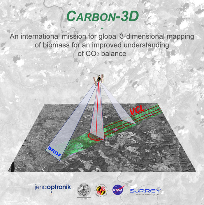
In 2003 the Friedrich-Schiller University Jena and the JenaOptronik GmbH proposed the Earth Observation mission “Carbon-3D” for global biomass mapping combination the Lidar system VCL (Vegetation Canopy Lidar) with a BRDF (Bidirectional Reflectance Distribution function) - imager on one platform. Carbon-3D improves knowledge about spatio-temporal patterns and magnitudes of major carbon fluxes between land, atmosphere and oceans, and allows quantifying above-ground stocks. Since land use, land use change and forestry activities as well as vegetation response to enhanced levels of atmospheric CO2 are major influences on greenhouse gas emissions, quantifying carbon stocks and changes is critical (Cihlar et al. 2002). Above-ground biomass stocks are also a key parameter in assessing the economic, conservation, and biofuel potential of land surfaces. The provision of a sensor that measures these stocks and their change in space and time is therefore paramount. The mission is also relevant for contributing key data on the environmental consequences of non-climatic global change resulting from continued global population growth, economic globalisation and expanding land use. |
[Home] [Theoretical Background] [Biomass Determination] [Mission Description] [Strategic Positioning] [The Carbon-3D Team] [References] Copyright © by FSU Jena 2004, Design by R. Fahlberg
|
||